![](/images/other/stat-length.png)
![Excursión A pie Gemeinde Mautern an der Donau - Welterbesteig Wachau Etappe 14 - Photo](https://media.geolcdn.com/t/1900/400/afac08bd-eae3-4980-87c7-31eae498f8b5.jpeg&format=pjpeg&maxdim=2)
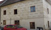
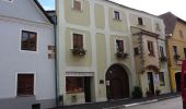
Welterbesteig Wachau Etappe 14
SityTrail - itinéraires balisés pédestres
Tous les sentiers balisés d’Europe GUIDE+
![Longitud](/images/other/stat-length.png)
Longitud
4 km
![Altitud máxima](https://static1.geolcdn.com/siteimages/upload/files/1508320355ic_sort_altitude_max_24dp.png)
Altitud máxima
221 m
![Desnivel positivo](https://static1.geolcdn.com/siteimages/upload/files/1508320355ic_sort_den_pos_24dp.png)
Desnivel positivo
48 m
![Km-Effort](/images/other/stat-length.png)
Km-Effort
4,6 km
![Altitud mínima](https://static1.geolcdn.com/siteimages/upload/files/1508320355ic_sort_altitude_min_24dp.png)
Altitud mínima
191 m
![Desnivel negativo](https://static1.geolcdn.com/siteimages/upload/files/1508320355ic_sort_den_neg_24dp.png)
Desnivel negativo
37 m
![Boucle](https://static1.geolcdn.com/siteimages/upload/files/16400158638029165_repeat_loop_refresh_sync_direction_icon.png)
Boucle
No
Baliza
Fecha de creación :
2022-02-16 16:55:21.019
Última modificación :
2022-03-03 14:11:36.761
![A pie](https://static1.geolcdn.com/sitytour/trail-icons/100.png)
1h02
Dificultad : Fácil
![Escanee este código QR para abrir la excursión en la aplicación SityTrail](https://capi.geolives.com/qq0zvz2zws4bq2lad0pu/sitytour/trails/3128304/qr.png?size=200)
Aplicación GPS de excursión GRATIS
A propósito
Ruta A pie de 4 km a descubrir en Baja Austria, Bezirk Krems, Gemeinde Mautern an der Donau. Esta ruta ha sido propuesta por SityTrail - itinéraires balisés pédestres.
Localización
País:
Austria
Región :
Baja Austria
Departamento/provincia :
Bezirk Krems
Municipio :
Gemeinde Mautern an der Donau
Localidad:
Unknown
Salida:(Dec)
Salida:(UTM)
542738 ; 5360229 (33U) N.
Comentarios
Excursiones cerca
![Excursión A pie - Stein a.d. Donau-Fesslhütte über Hengelwand (grün) - Photo](https://media.geolcdn.com/t/375/260/179d8dcc-c2a9-43b0-bcc1-e94e1ef7a231.jpeg&format=jpg&maxdim=2)
![A pie A pie](https://static1.geolcdn.com/sitytour/trail-icons/100.png)
Stein a.d. Donau-Fesslhütte über Hengelwand (grün)
A pie
Fácil
,
Baja Austria,
Krems an der Donau,
Austria
![](/images/other/stat-length.png)
3,2 km | 6,1 km-effort
1h 22min
![](https://static1.geolcdn.com/siteimages/upload/files/16400158638029165_repeat_loop_refresh_sync_direction_icon.png)
No
![Excursión A pie Gemeinde Dürnstein - Loibner Holzweg zur Kreuzung Hengelwand (blau) - Photo](https://media.geolcdn.com/t/375/260/8bbb0388-ba45-4631-adbe-ff08512df595.jpeg&format=jpg&maxdim=2)
![A pie A pie](https://static1.geolcdn.com/sitytour/trail-icons/100.png)
Loibner Holzweg zur Kreuzung Hengelwand (blau)
A pie
Fácil
Gemeinde Dürnstein,
Baja Austria,
Bezirk Krems,
Austria
![](/images/other/stat-length.png)
3,5 km | 6,5 km-effort
1h 29min
![](https://static1.geolcdn.com/siteimages/upload/files/16400158638029165_repeat_loop_refresh_sync_direction_icon.png)
No
![Excursión A pie Bergern im Dunkelsteinerwald - Welterbesteig Wachau Etappe 13 - Photo](https://media.geolcdn.com/t/375/260/afac08bd-eae3-4980-87c7-31eae498f8b5.jpeg&format=jpg&maxdim=2)
![A pie A pie](https://static1.geolcdn.com/sitytour/trail-icons/100.png)
Welterbesteig Wachau Etappe 13
A pie
Medio
Bergern im Dunkelsteinerwald,
Baja Austria,
Bezirk Krems,
Austria
![](/images/other/stat-length.png)
16,7 km | 22 km-effort
5h 2min
![](https://static1.geolcdn.com/siteimages/upload/files/16400158638029165_repeat_loop_refresh_sync_direction_icon.png)
No
![Excursión A pie Gemeinde Paudorf - Göttweiger Wald-Erlebnisweg - Photo](https://media.geolcdn.com/t/375/260/9671c510-ee85-4141-8b9c-416c552b2c23.jpeg&format=jpg&maxdim=2)
![A pie A pie](https://static1.geolcdn.com/sitytour/trail-icons/100.png)
Göttweiger Wald-Erlebnisweg
A pie
Fácil
Gemeinde Paudorf,
Baja Austria,
Bezirk Krems,
Austria
![](/images/other/stat-length.png)
3,3 km | 4,8 km-effort
1h 5min
![](https://static1.geolcdn.com/siteimages/upload/files/16400158638029165_repeat_loop_refresh_sync_direction_icon.png)
Sí
![Excursión A pie Gemeinde Dürnstein - Welterbesteig Wachau Etappe 2 - Photo](https://media.geolcdn.com/t/375/260/e2b33569-3587-4803-b6ba-8fa6bd109712.jpeg&format=jpg&maxdim=2)
![A pie A pie](https://static1.geolcdn.com/sitytour/trail-icons/100.png)
Welterbesteig Wachau Etappe 2
A pie
Medio
Gemeinde Dürnstein,
Baja Austria,
Bezirk Krems,
Austria
![](/images/other/stat-length.png)
16,3 km | 25 km-effort
5h 41min
![](https://static1.geolcdn.com/siteimages/upload/files/16400158638029165_repeat_loop_refresh_sync_direction_icon.png)
No
![Excursión A pie - Welterbesteig Wachau Etappe 1 - Photo](https://media.geolcdn.com/t/375/260/ba58ddd1-b23b-443d-8abc-3d71ad954808.jpeg&format=jpg&maxdim=2)
![A pie A pie](https://static1.geolcdn.com/sitytour/trail-icons/100.png)
Welterbesteig Wachau Etappe 1
A pie
Fácil
,
Baja Austria,
Krems an der Donau,
Austria
![](/images/other/stat-length.png)
12,9 km | 18,7 km-effort
4h 15min
![](https://static1.geolcdn.com/siteimages/upload/files/16400158638029165_repeat_loop_refresh_sync_direction_icon.png)
No
![Excursión A pie Gemeinde Furth bei Göttweig - AT-P3 - Photo](https://media.geolcdn.com/t/375/260/b8a19b7d-62af-4d7f-8cf6-5ae3635b1580.jpeg&format=jpg&maxdim=2)
![A pie A pie](https://static1.geolcdn.com/sitytour/trail-icons/100.png)
AT-P3
A pie
Fácil
Gemeinde Furth bei Göttweig,
Baja Austria,
Bezirk Krems,
Austria
![](/images/other/stat-length.png)
4,3 km | 6,6 km-effort
1h 29min
![](https://static1.geolcdn.com/siteimages/upload/files/16400158638029165_repeat_loop_refresh_sync_direction_icon.png)
Sí
![Excursión Cicloturismo - Krems Wien - Photo](https://media.geolcdn.com/t/375/260/ext.jpg?maxdim=2&url=https%3A%2F%2Fstatic1.geolcdn.com%2Fsiteimages%2Fupload%2Ffiles%2F1524743154velo.jpg)
![Cicloturismo Cicloturismo](https://static1.geolcdn.com/sitytour/trail-icons/204.png)
Krems Wien
Cicloturismo
Medio
,
Baja Austria,
Krems an der Donau,
Austria
![](/images/other/stat-length.png)
69 km | 78 km-effort
21h 13min
![](https://static1.geolcdn.com/siteimages/upload/files/16400158638029165_repeat_loop_refresh_sync_direction_icon.png)
No
![Excursión Senderismo Gemeinde Dürnstein - Autriche - Dürnstein (Wachau) - Photo](https://media.geolcdn.com/t/375/260/ext.jpg?maxdim=2&url=https%3A%2F%2Fstatic1.geolcdn.com%2Fsiteimages%2Fupload%2Ffiles%2F1553511878bg_sport_marche.png)
![Senderismo Senderismo](https://static1.geolcdn.com/sitytour/trail-icons/101.png)
Autriche - Dürnstein (Wachau)
Senderismo
Fácil
Gemeinde Dürnstein,
Baja Austria,
Bezirk Krems,
Austria
![](/images/other/stat-length.png)
6,4 km | 9,5 km-effort
2h 31min
![](https://static1.geolcdn.com/siteimages/upload/files/16400158638029165_repeat_loop_refresh_sync_direction_icon.png)
Sí